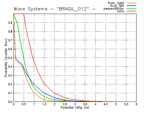
The figure shows the line parallel to the 100-m isobath used to decompose the incident wave power in perpendicular, from left, and from right directions.
SIMCOS - Forecasting System and Coastal Monitoring along the Brazilian Coast
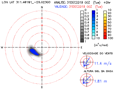
The map on the left localizes in yellow the monitored point and in red some points around, which can be acessed from the figure.
For detailed procedure adopted to obtain the results presented in this page were computed, click on ABOUT THE PROJECT.
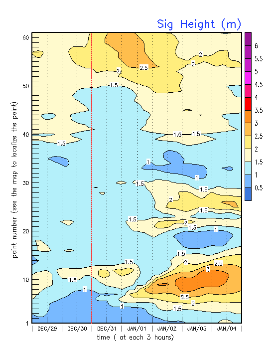
Sig Height and Percentil
Ave Period and Percentil
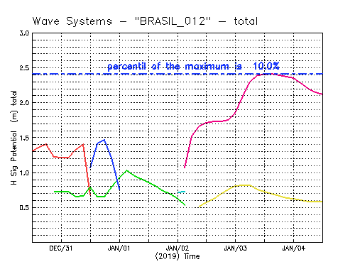
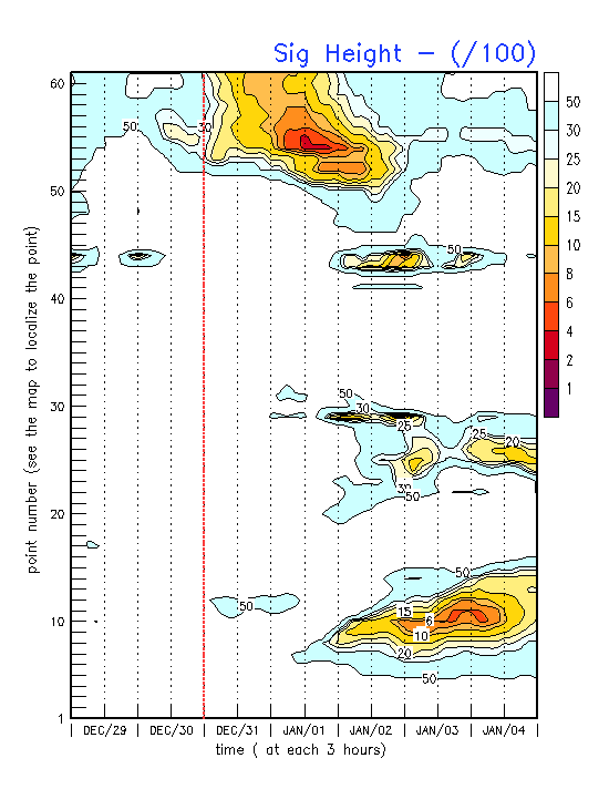
Pot Sig Height and Percentil
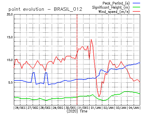
Peak Period and Percentil
Pot Sig Height Perpendicular and Percentil
Total
Perpendicular
From Right
From Left
X fechar
Clique sobre a imagem para movimenta-lá
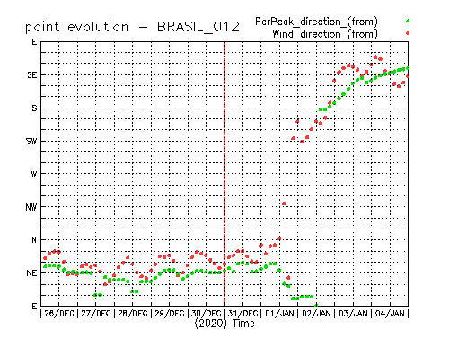
PONTO 012 - BRASIL/SUL - LATITUDE: -29.0230şS - LONGITUDE: 311.48181şW
» Probability the Wave System (Total, Perpendicular, From Right, From Left)